

Application Description
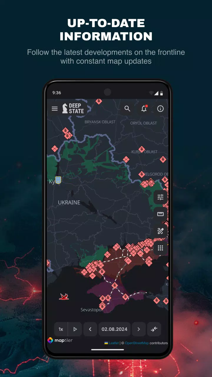
DeepStateMap.Live is the definitive interactive online platform for tracking the hostilities in Ukraine, providing real-time insights into the Russian-Ukrainian war. This tool offers an up-to-date visualization of the conflict, displaying the locations and movements of Russian military units. One of its key features is the ability to cache downloaded data, ensuring users can access information even when offline.
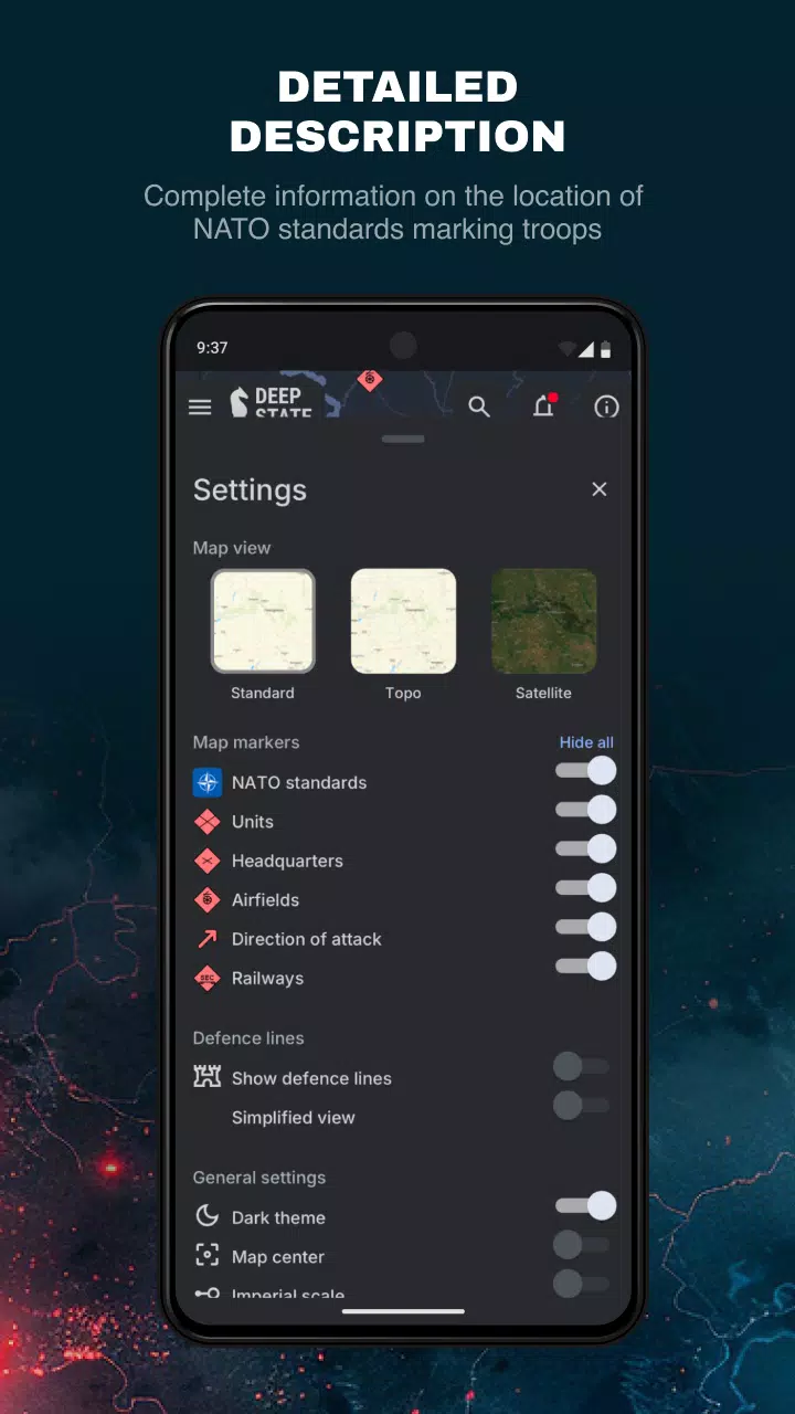
The map utilizes distinct symbols to represent various territories and military assets:
- Territories of Ukraine liberated from occupation within the last two weeks
- Liberated territories
- Territories that require further verification
- Territories occupied by Russian forces
- Occupied Crimea and ORDLO territories
- Transnistria region
- Russian military units, referred to as "rashists units"
- Russian military headquarters, known as "rashists headquarters"
- Russian airfields, labeled as "rashists airfields"
- Russian naval forces, indicated as "rashists fleet"
- Directions of Russian military attacks, or "rashists attacks"
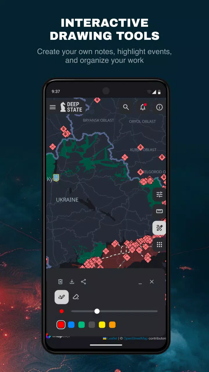
The map divides the territory into zones, each color-coded for clarity, and marks the precise locations of Russian military units and airfields. Beyond mapping, DeepStateMap.Live features a comprehensive news feed and a tool for measuring distances between points on the map. Users can also activate a display of fire points using NASA Firms system data, allowing for comparisons with the current front line. A specialized mode enables users to assess the range of various artillery systems, such as HIMARS, M777, and CAESAR, across the entire front line.
What's New in the Latest Version 2.0.3
Last updated on Aug 13, 2024
DeepStateMap.Live version 2.0.3 brings minor bug fixes and improvements. Ensure you install or update to the newest version to experience these enhancements firsthand!
DeepStateMap Screenshots
Reviews
Post Comments
Trending Games
Trending apps


Topics
More
Latest Articles
More


Top Pokémon for 2025: Unite Tier List Revealed
Apr 28,2025
"Minecraft Guide: Obtaining Armadillo Scutes"
Apr 28,2025