Application Description
For astronomy enthusiasts, the Light Pollution Map - Dark Sky app is an indispensable tool for conquering the night sky. It pinpoints the darkest locations ideal for stargazing and astrophotography, eliminating the frustrating effects of light pollution. But its functionality extends far beyond simple location finding.
This comprehensive app provides a wealth of features, including detailed cloud cover maps, real-time temperature readings, and captivating aurora overlays. Track the International Space Station (ISS) with live map tracking and webcam feeds, receive timely alerts for meteor showers, lunar eclipses, and ISS flyovers, and delve into comprehensive moon phase information, including rise and set times. Further enhancing its utility are astronomy calculators, live aurora and magnetic field data, and a night sky calendar to plan your celestial observations.
With customizable widgets, a convenient night mode, and elegant AMOLED themes, Light Pollution Map - Dark Sky offers a truly immersive and personalized experience.
Features of Light Pollution Map - Dark Sky:
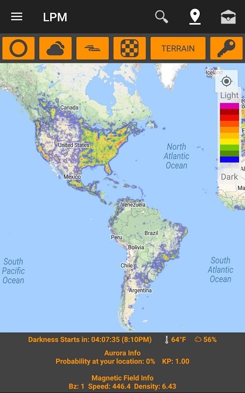
Map Features: Effortlessly locate dark sky sites perfect for stargazing and astrophotography. Customize map settings to your preferences and use the horizon safe radius tool to avoid light pollution interference.
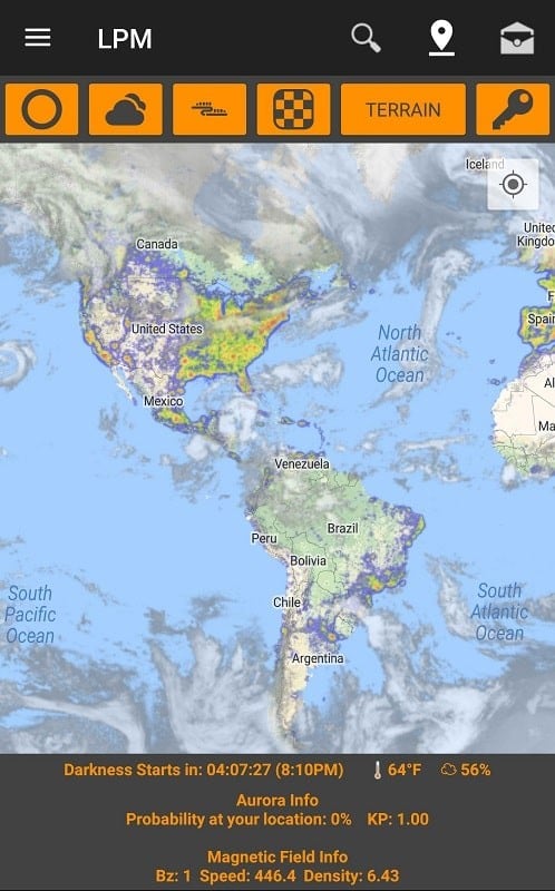
Cloud Cover & Temperature Info: Quickly determine the suitability of observing conditions with integrated cloud cover and temperature data. No more wasted trips on cloudy nights!
ISS Tracker: Track the ISS in real-time on a live map, view live webcam feeds, and receive notifications when it passes overhead.
Alerts & Notifications: Stay updated on upcoming celestial events with customizable alerts for meteor showers, supermoons, lunar eclipses, aurora activity, and ISS sightings.
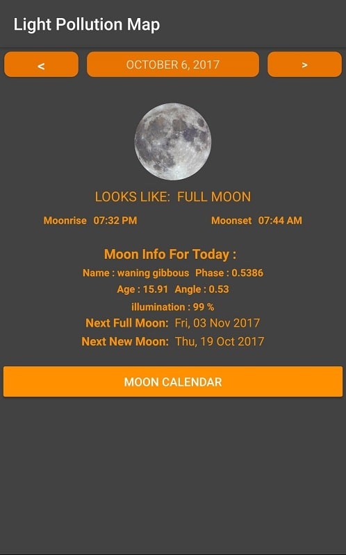
Moon Information: Access detailed moon phase information, rise/set times, and comprehensive moon data for any location and date.
Astronomy Tools: Utilize various built-in calculators, explore live aurora webcams, pinpoint moon positions, and discover optimal viewing days with the Night Sky Calendar.
Conclusion:
Light Pollution Map - Dark Sky is the ultimate resource for astronomy enthusiasts, offering a complete suite of tools for planning and enjoying celestial observations. Its user-friendly interface, customizable settings, and wealth of information make it an essential app for anyone passionate about exploring the universe. Download it today and embark on your astronomical adventures!
Light Pollution Map - Dark Sky Screenshots
Reviews
Post Comments
Trending Games
Trending apps


Topics
More