Application Description
Zoom Earth stands as a premier platform for tracking hurricanes, typhoons, and tropical cyclones in real-time, offering a comprehensive suite of tools to stay informed and safe during severe weather events. As an interactive global weather map, Zoom Earth harnesses the power of advanced technology to provide detailed insights into weather patterns and natural disasters across the world.
[Key Features]
Satellite Imagery: Gain access to near real-time satellite imagery from leading sources like NOAA GOES, JMA Himawari, EUMETSAT Meteosat, and NASA's Aqua and Terra polar-orbiting satellites. This feature ensures you have the most up-to-date visuals of weather systems, including hurricanes and typhoons.
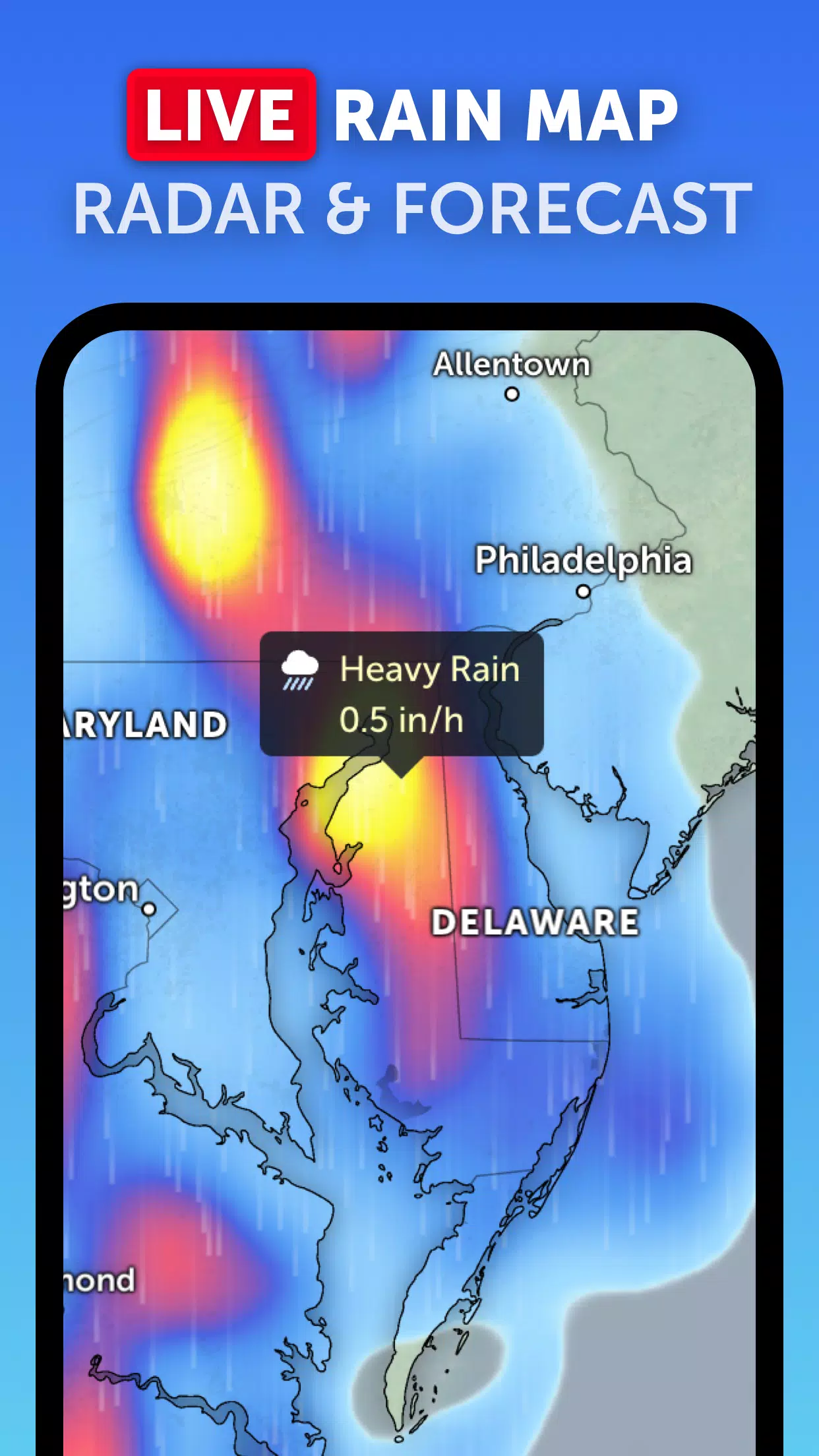
Rain Radar: Stay one step ahead of the storm with our detailed weather radar map. It displays rain and snow as detected by ground-based doppler radar, offering real-time updates to keep you informed about incoming weather conditions.
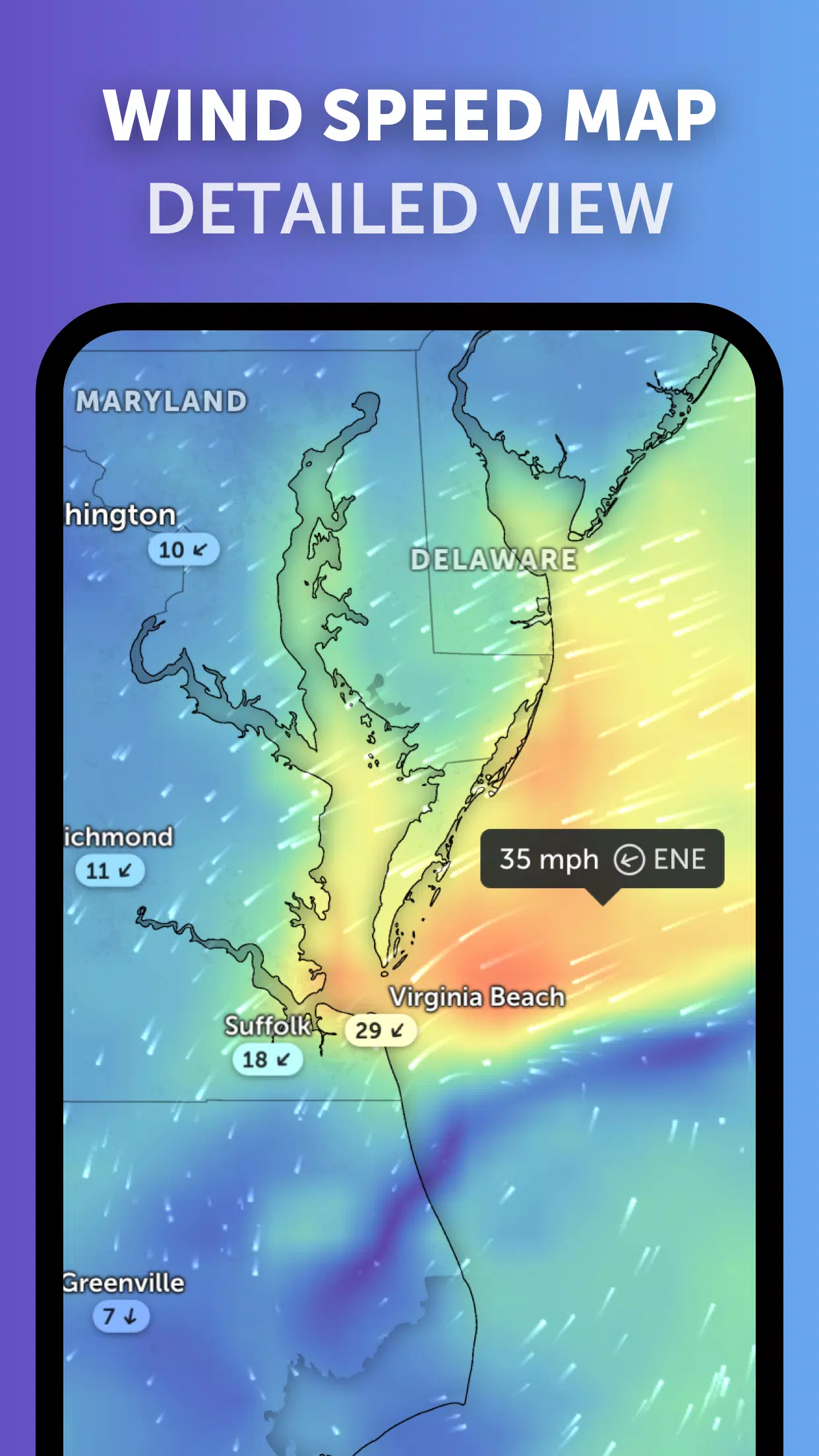
Weather Forecast Maps: Immerse yourself in visually stunning and interactive global forecast maps. These maps provide comprehensive data on precipitation, wind speed and gusts, temperature, "feels like" temperature, relative humidity, dew point, and atmospheric pressure, helping you plan and prepare effectively.
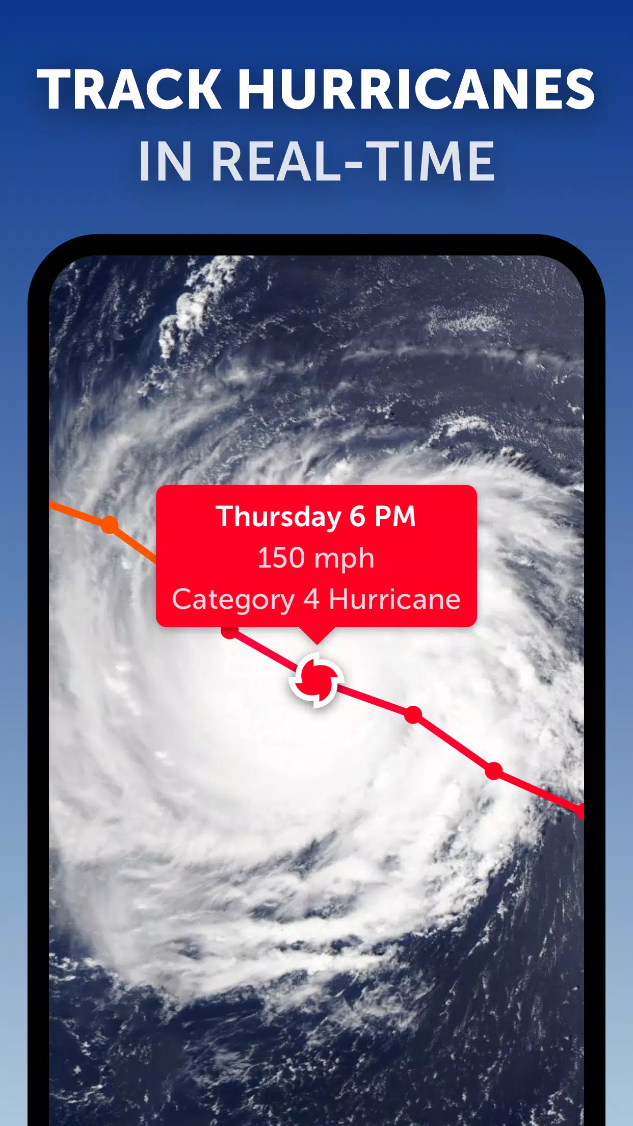
Hurricane Tracking: Track the progression of hurricanes from their nascent stages to powerful category 5 storms with our top-tier tropical tracking system. Utilizing the latest data from the National Hurricane Center (NHC), Joint Typhoon Warning Center (JTWC), Naval Research Laboratory (NRL), and the International Best Track Archive for Climate Stewardship (IBTrACS), you'll have all the information you need at your fingertips.
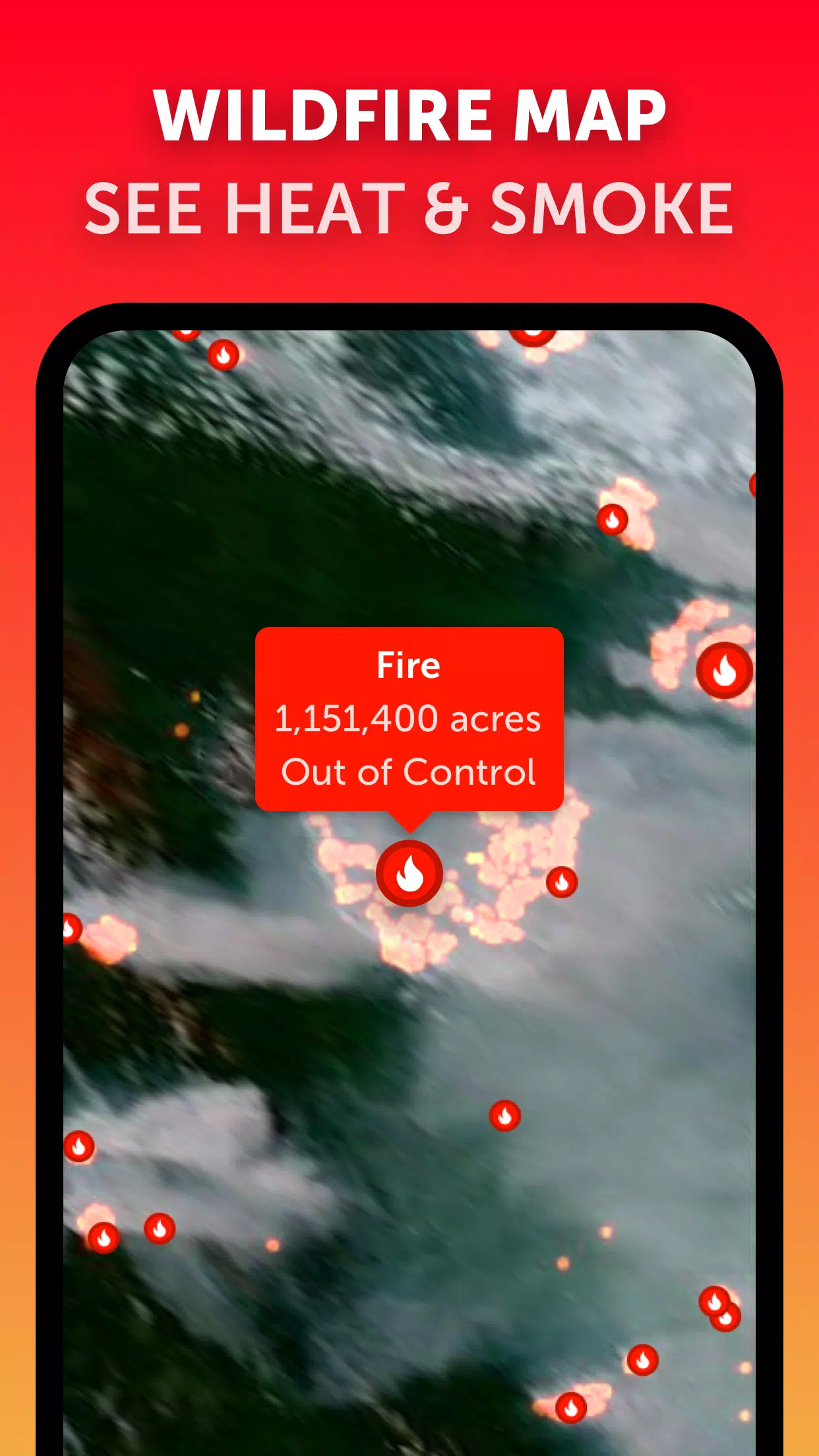
Wildfire Tracking: Keep an eye on wildfires with our active fires and heat spots overlay. This feature uses daily updates from NASA's Fire Information for Resource Management System (FIRMS) to show points of very high temperature detected by satellite, helping you monitor the spread and intensity of wildfires.
Customization: Tailor your experience with comprehensive settings that allow you to adjust temperature units, wind units, time zone, animation styles, and more. This ensures that the information you receive is presented in a way that suits your preferences and needs.
What's New in the Latest Version 3.1
Last updated on Sep 19, 2024
- Enhanced user experience with reduced clutter when viewing multiple tropical systems.
- Improved functionality with separate alerts for Atlantic and Eastern Pacific systems.
- Refined map labels for clearer and more precise information display.
Zoom Earth Screenshots
Reviews
Post Comments
Trending Games
Trending apps