

Application Description
Experience seamless outdoor adventures with Mapas de España, a comprehensive and user-friendly app designed for hikers, cyclists, runners, and skiers. This free mapping application offers detailed maps from Spain's National Geographic Institute and other government sources. Plan your excursions, track your progress, and navigate with pinpoint accuracy, even without internet access. Supporting multiple languages (Spanish, Catalan, Galician, Basque, and English) and various map services, it's perfect for both professionals and enthusiasts. Discover the beauty of Spain with Mapas de España.
Key Features of Mapas de España:
- Precise GPS Location: Determine your location accurately, even without cellular service.
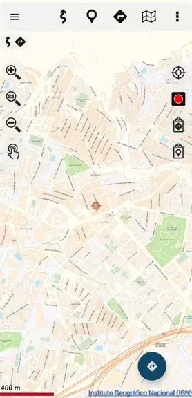
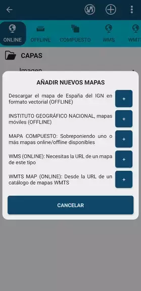
- Offline Map Access: Download maps beforehand for use in areas without internet connectivity.
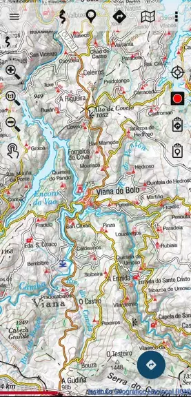
- Route Tracking: Create and follow routes on National Geographic Institute maps.
- Track Management: Save and view tracks in various formats, including GPX, KML, and KMZ.
- IGN Map Service Integration: Access WMS and WMTS map services for enhanced geospatial data.
- Multilingual Support: Available in Spanish, Catalan, Galician, Basque, and English.
User Tips:
- Pre-download Maps: Ensure offline access by downloading maps in advance.
- Accurate Route Tracking: Utilize the GPS tracking feature for precise route recording.
- Track Saving: Save tracks in compatible formats for future reference and analysis.
- Guided Tour Planning: Plan excursions using the app's mapping and navigation tools.
- Positioning Tools: Leverage coordinate, speed, and altitude data for precise navigation.
Conclusion:
Mapas de España is a versatile and easy-to-use app providing a comprehensive suite of tools for various outdoor activities. With offline map capabilities, GPS tracking, and multilingual support, it's the ideal companion for your next Spanish adventure. Download Mapas de España today and explore with confidence!
Mapas de España Screenshots

Reviews
Post Comments
Trending Games
Trending apps


Topics
More
Best Tools for Home Improvement Projects
Fun Educational Games to Learn and Play
Immersive Strategy Games: Dive into Tactical Combat
Hyper-Casual Games: Fun and Addictive Mobile Games
Essential Tools for Everyday Life
Top Lifestyle Apps to Enhance Your Life
Top-Rated Adventure Games to Play Now
Best Strategy Games for Android
Latest Articles
More

Top Affordable VR Headsets Reviewed
Apr 20,2025
Honkai: Star Rail Promo Codes for March 2025
Apr 20,2025