

Application Description
Are you ready? JaxReady, a vital resource brought to you by the Emergency Preparedness Division and Information Technologies Division of the City of Jacksonville, Florida, is here to assist you in monitoring weather threats and planning for evacuation in the event of a natural disaster. With JaxReady, you can easily access current threat levels, detailed weather reports, and the latest wildfire updates, along with real-time news feeds that keep you informed on emergency preparedness and evacuation procedures.
Features
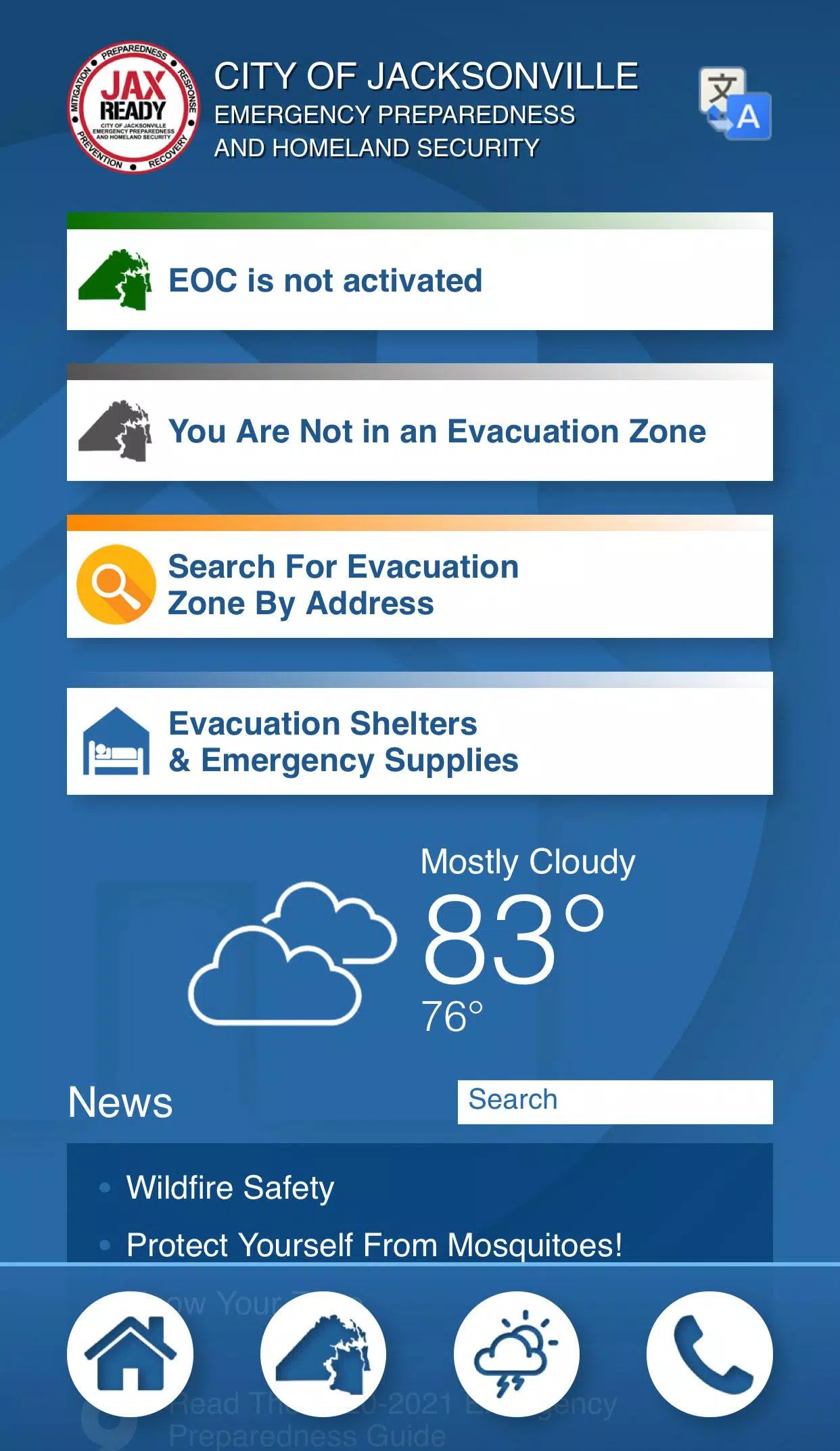
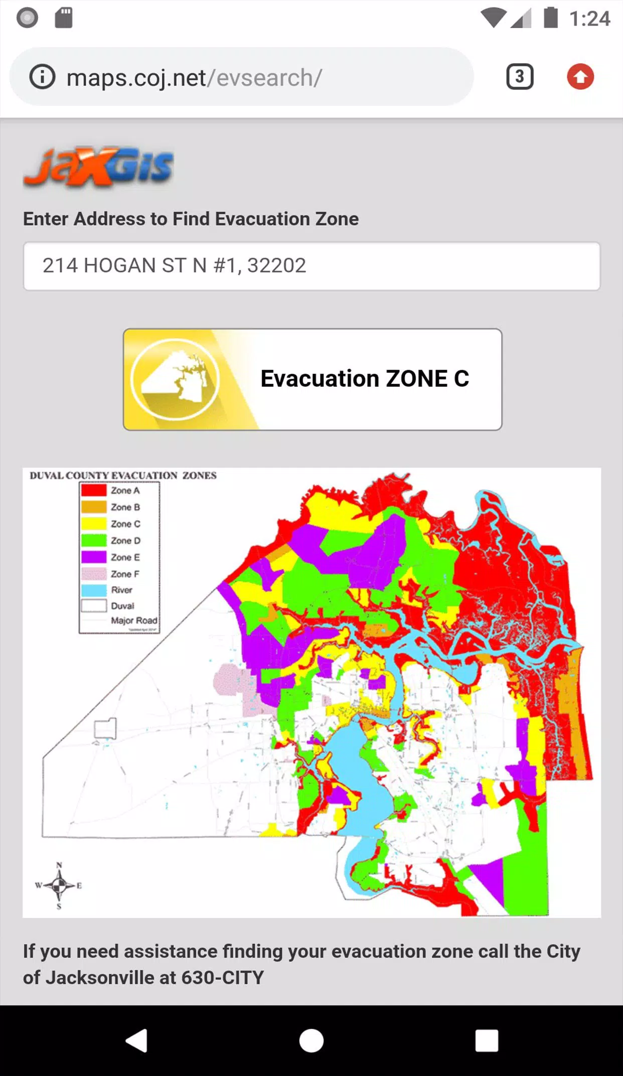
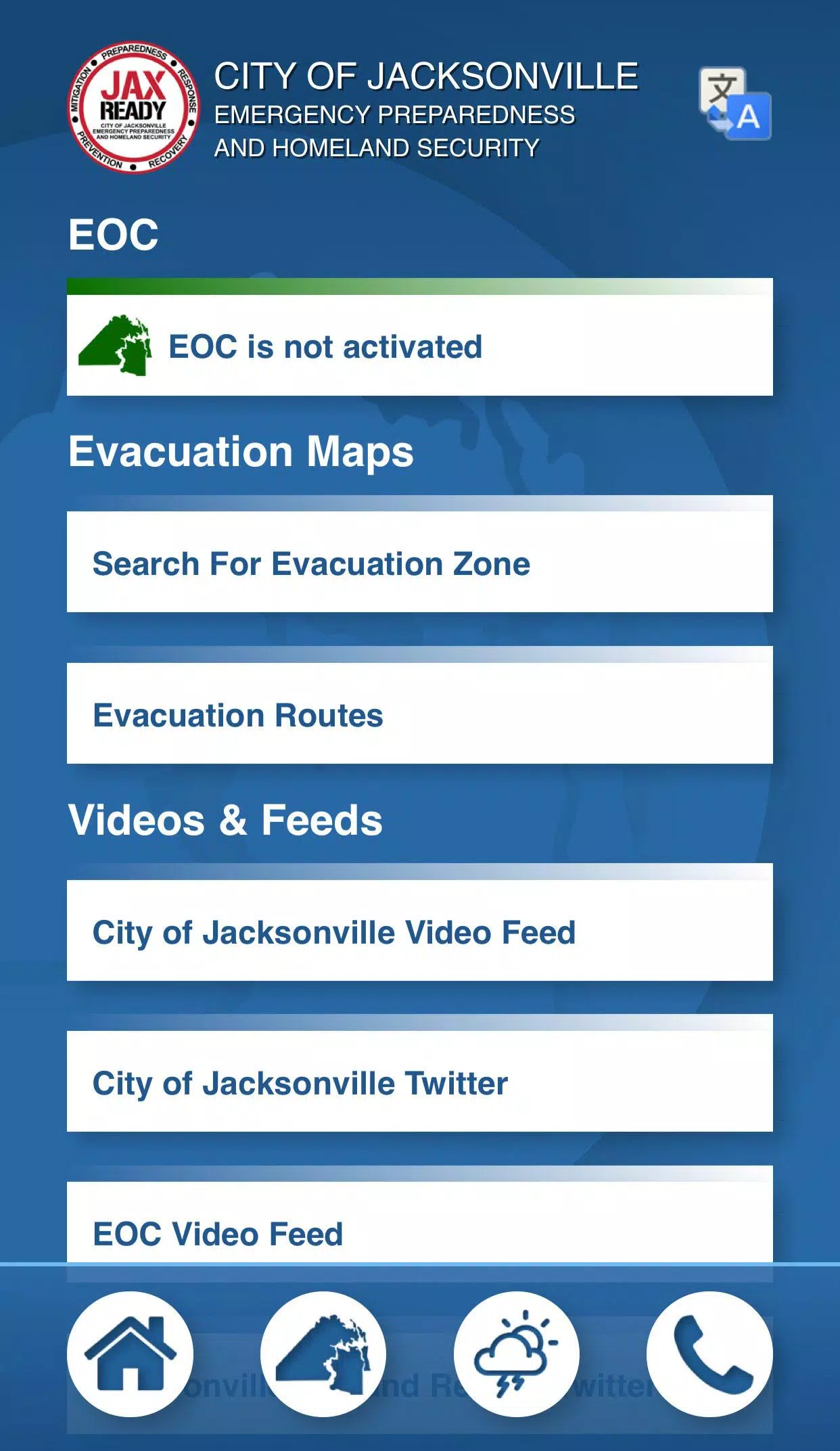
- GPS Functionality: JaxReady uses GPS to pinpoint your exact Evacuation Zone, ensuring you receive the most relevant information for your location.
- Real-Time Alerts: Stay updated with the current Emergency Operations Center (EOC) Activation Level, Weather Threat Level, and Fire Danger Index, all tailored to your geolocation.
- Special Needs Support: Access links to register for special needs, ensuring those with medical requirements are taken care of during an evacuation.
- Comprehensive News: Stay informed with the latest weather and fire news, helping you make informed decisions quickly.
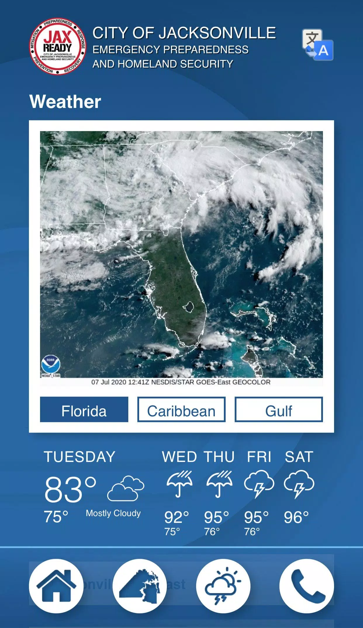
- Detailed Maps: View weather, wildfire, and drought index maps to understand the situation at a glance and plan accordingly.
With these features, JaxReady empowers Jacksonville residents to be proactive and prepared, ensuring you're never caught off guard by natural disasters.
JaxReady Screenshots
Reviews
Post Comments
Trending Games
Trending apps


Topics
More
Top-Rated Productivity Tools to Boost Your Workflow
Best Casino Games Online
Essential Other Apps for Your Phone
Best Role Playing Games for Android
Epic Adventure Games: Explore Uncharted Worlds
Hyper-Casual Games: Fun and Addictive Mobile Games
Top Arcade Classics and New Hits
Best Media & Video Players for Android
Latest Articles
More


Assassin's Creed Shadows Unveils Canon Mode
Apr 25,2025
Exploring Overwatch 2: Understanding the C9 Term
Apr 25,2025